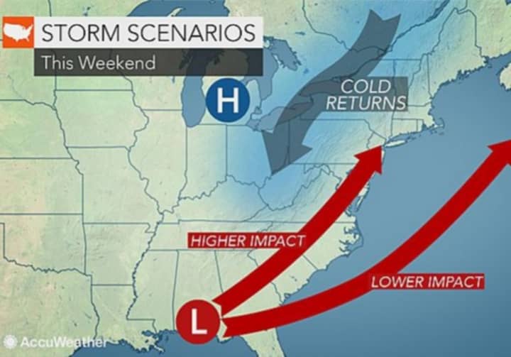
Temperatures in North Jersey will slide from the low 60s to the high 40s Friday through Monday and possibly into Tuesday -- with lows in the mid 20s, AccuWeather reports.
That will make it cold enough to "set the stage for spotty flurries or perhaps a period of heavy snow" in some areas from Sunday into Monday, depending on path of a storm sweeping up from the South, the site says.
"This far out there are many variables that could affect the track of the storm, which has not formed yet, so it is too early to call one way or another," AccuWeather Chief Meteorologist Elliot Abrams said.
If it hugs the Atlantic Coast, Bergen and Passaic are most likely looking at all rain.
Any type of hook on-shore could dump wet snow from Washington, D.C., through Philadelphia and New York City to Boston.
"Even in the absence of a storm along the coast, flurries could produce the first snowflakes in two weeks or more for parts of southern New England and the mid-Atlantic region," AccuWeather Lead Long-Range Meteorologist Paul Pastelok said.
The good news: "Because of the recent warmth, some of the wet snow will melt as it falls, especially on paved areas."
Temperatures will finally push back into the 50s on Wednesday, with the possibility of breaking 60 on Easter Sunday, AccuWeather reports.
Click here to follow Daily Voice Ridgewood and receive free news updates.


